Sicilian Horse Riding – Horse Riding Tours
Detail
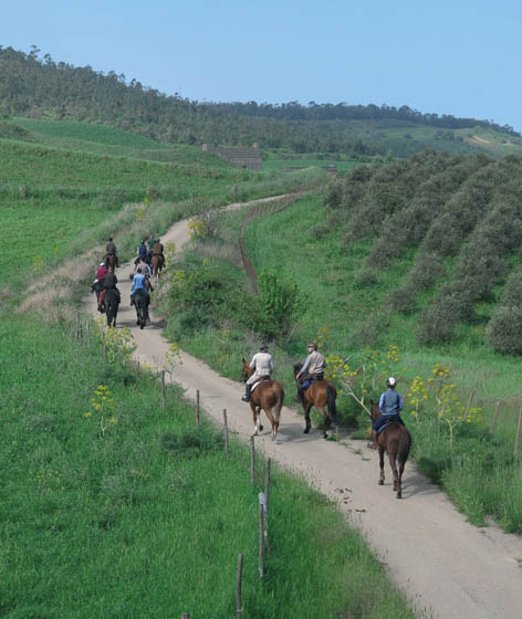
For those who want to treat themselves to a holiday or a simple horseback ride, with the times and rhythms dictated by this wonderful travel companion, the beauty of the Sicilian landscapes is a unique opportunity.
It’s an experience enriched by the presence of cultural attractions, away from the usual circuits, with a surprising variety of food and wine products and craftsmanship, a legacy of the rulers who have succeeded each other over the centuries and who have made this island a land steeped in influences, ancient traditions and cultures.

The tours we offer have been selected by how accessible they are to tourists and take place within more than 11000 kilometres of dirt road in Sicily, and offer numerous services, signage, rest stops, adequate support from experienced guides and horses accustomed to equestrian tourism, to offer you unforgettable walks in absolute safety.
A good part of these routes are aimed without major restrictions to all lovers of outdoor sports, adapting so they can be done, with the appropriate equipment, by mountain bike or, for lovers of trekking, simply on foot.
Here are some of the many possible trails in Sicily.
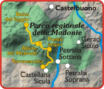
Starting point: Castellana Sicula (PA)
– altitude a.s.l .: from 950m up to 1800m
– route lenght : about km 22
– travel time : 4 hours (combined pace)
– technical difficulty: medium
– required equipment : gaiters/boots – cap/helmet
– available boxes : 10
– recommended period : between 20 March and 15 October
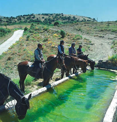
Antico abbeveratoio – ph. Paolo Barone
The Madonie Park is known for its great availability of nature trails for horseriding; we suggest you this route among many: along its compacted earth trail, you’ll cross ancient villages, and old drinking troughs for the cattle, and enjoy a landascape alternating between wooded mountain areas and barren hills, providing amazing views.
Don’t miss a visit to the Sanctuary of Madonna dell’Alto. Located 1600 metres high it’s the highest in Europe and overlooks the Madonie woods and the valleys below. Monte Quacella, located in Quacella area, is considered the botanical garden of the Madonie Mountains. It rises immediately north from Madonna degli Angeli Valley, a famous for hosting many of the 30 unique worldwide specimens of Abies nebrodensis (fir of the Nebrodi Mountains), an endemic species dating back to the ice age.
Among the hikers favorite destinations hikers there is Piano Cervi, where an easy trail, surrounded by a thick forest vegetation, leads up to wide green spaces.
For more information on the natural areas, visit the Madonie Park website and/or contact the Forest Service – Reparto Ippomontato Madonie – phone +39 091 562437 – mobile. +39 331 5702081
2019 Studio Russo – tutti i diritti riservati
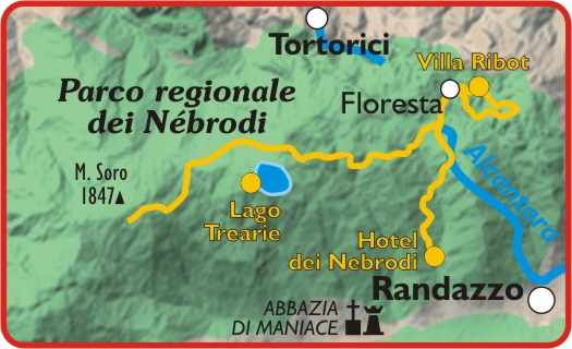
Starting point: Floresta (ME)
Route 1: Floresta – Lake Cartolari
– altitude a.s.l .: from 1200 m up to 1400 m
– route lenght : about 30 km
– travel time: 6 hours (combined pace) , 1 hour break
– technical difficulty : medium – high
– required equipment : gaiters/boots – cap/helmet
– available boxes: fences and houseposting or, as an alternative, public stables
– recommended period : between 15 April and 20 September
Route 2: Floresta – Mount Colla
– altitude a.s.l.: from 1200 m up to 1500 m
– route lenght : about 15 km
– travel time: 6 hours (combined pace) , 1 hour break
– technical difficulty: medio / alte
– required equipment : gaiters/boots – cap/helmet
–available boxes: fences and houseposting or, as an alternative, public stables
– recommended period : between 15 April and 20 September
Route 3: Floresta – Favoscuro
– altitude a.s.l: about 1200 m
– route lenght : about 6,5 km
– travel time: two and a half hours (combined pace)
– technical difficulty: medie – percorso a margherita
– required equipment : gaiters/boots – cap/helmet
– available boxes: fences and houseposting only
– recommended period : between 15 April and 20 September
ph. Paolo Barone
This important village into the Nebrodi Valley provides healty walks along a 1100-400 high path, surrounded by wide pastures where the largest local cattle and goats populations live: outstanding location in producing of fresh/hard and soft cheeses to taste with some cold meats.
The surrounding includes woods full of beeches, oaks and downy oaks, which for the wide extension should be called forests, where, even in summer, the sun can hardly goes through.
The area provides a wide range of routes; we suggest you to try those that reach up to the natural lakes Tre Arie and Cartolari.
Along these paths it may happen to spot vultures, endemic to this area, together with wild cats, black pigs and incredible herds of wild horses, belongin to the Sanfratellana breed, freely running around.
For more information about these natural areas, visit the Parco dei Nebrodi website or contact +39 095 697818
2019 Studio Russo – tutti diritti riservati
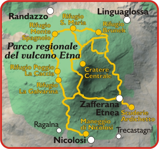
1st starting point: Santa Venerina (CT)
2nd starting point: Nicolosi (CT)
– altitude a.s.l .: from 330 m up to 2970 m
– route lenght : every possible route is not less than 25 km
– travel time: from 6 hours up to days
– technical difficulty: medium-high
– required equipment : gaiters/boots – cap/helmet, high mountain outfit
– available boxes: 20 for each starting point
– recommended period : between 20 Aprile and 30 September
ph P. Barone
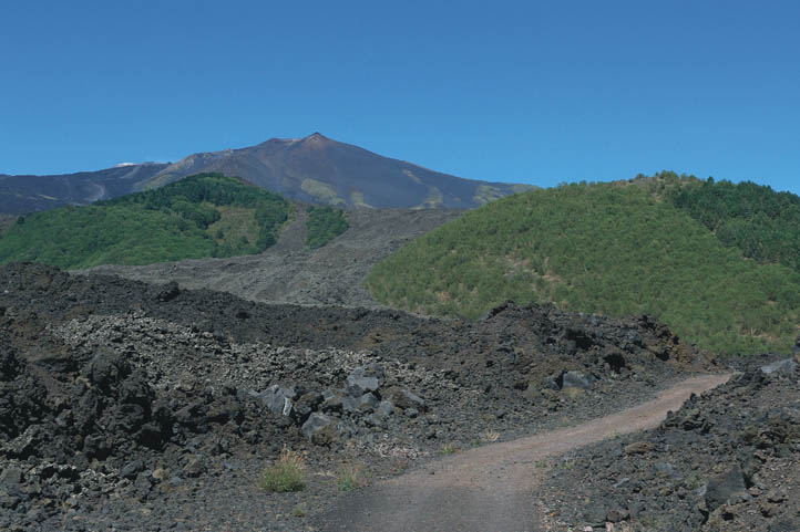
The rich opportunities offered by Mount Etna, the largest active volcano in Europe, included in the UNESCO World Heritage list, make it one of the most attractive areas in Sicily.
Its incredible and varied touristic offer satisfies a larg number of hikers with different skills, who will have to deal with a very particular territory, switched between a rugged nature, made mostly of sand and volcanic formations with their characteristic black color, and wooded areas, mostly beechs and birch trees, which have survided the lava flows throughout millennia.
The possibility to go around on a horseback for three days does performing a complete tour around Etna, and reaching almost the top at an altitude of 3000 meters a.s.l., does not exclude alternative routes at lower altitudes, lasting from 2 to 5 hours, with panoramic, breathtaking views over the whole Ionian coast.
Not to mention the extraordinary faunal and floral biodiversity of the all area around Etna.
For more information about these natural areas, visit the Parco dell’Etna website or contact +39 095 821111
2019 Studio Russo – tutti i diritti riservati
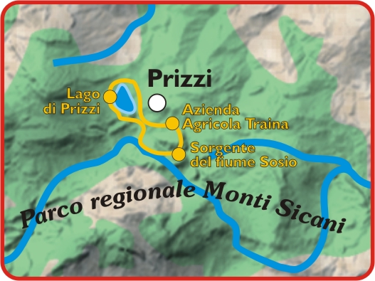
Starting point: Prizzi (PA)
Route 1: Source of River Sosio
– altitude a.s.l .: from 600 m up to 750 m
– route lenght : about 7 km
– travel time : 4 hours (combined pace) , 1 hour break
– technical difficulty: medium-low
– required equipment : gaiters/boots – cap/helmet
– available boxes : 6 and, as as an alternative, housepostings and fences
– recommended period : between 20 March and 30 September
Route 2: Lake Prizzi
– altitude a.s.l .: from 600 m up to 750 m
– route lenght : about 15 km
– travel time : 7 hours (combined pace) , 1 hour break
– technical difficulty: medium-low
– required equipment : gaiters/boots – cap/helmet
– available boxes : 6 housepostings and fences
– recommended period : between 20 March and 30 September
p. Paolo Barone
Monte Scuro represents an area of the park particulary rich of historical and naturalistic charm. here the river sosio rises and, crossing the Sicanian area for over over 60 km, reaches the Mediterranean sea, flowing between the villages of Ribera and Sciacca.
The area include an ancient and dense wood, rich in full of oaks, holm oaks and downy oaks which in late 1800s and the early 1900s housed coal bins and mule tracks, nowadays partially walkable. This nature and very panoramic excursion goes along a level variance of about 700 meters, and reaches an altitude of about 1200 m a.s.l.
Climbing Monte Indisi, on the border between Prizzi and Palazzo Adriano areas, you can enjoy the wonderful panorama provided by the Reserve of Sosio Valley and a large part of the Sicani Mountains, and, a little further up, Rocca Busambra (Ficuzza), the villages of Giuliana and Chiusa Sclafani, Monte Carcaci and Monte Cammarata.
Along the source of the river Sosio, during the warmest months, it is possible to freshen up into the crystal clear waters, and explore the tunnels dug into the rock to find the spring waters. The walking goes on towards Monte Scuro forest on the trails of an ancient mule track, once used by the coal men, that provides a stunning view over a dense forest and then reaches a wide valley with pastures and soils cultivated with cereals.
For more information about these natural areas, visit the Parco dei Monti Sicani website or contact +39 366 6805077
2019 Studio Russo – tutti i diritti riservati
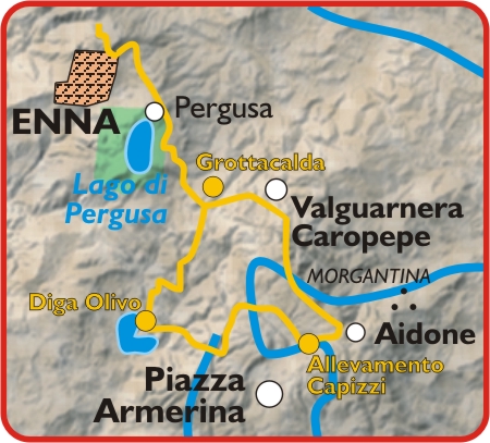
Starting point: : Valguarnera Caropepe (EN)
– altitude a.s.l .: from 600 m up to 750 m
– route lenght: about km 65
– travel time: 2 days combined pace, breaks, refreshment and overnight stay
– technical difficulty: medium – low
– required equipment: gaiters/boots – cap/helmet
– available boxes: 3 plus 20 houseposting at the starting point, 10 boxes for the night break
– recommended period: between 20 March and 30 September
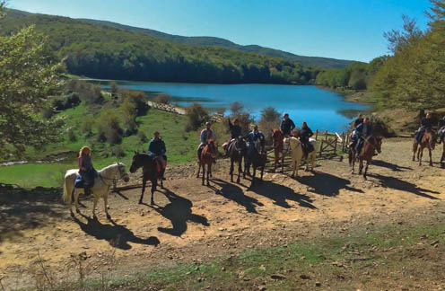
Diga Olivo – ph. Paolo Barone
The walk in this area goes mostly through a vast forest, rich of non-endemic species such as eucalyptus, planted in the 1950s and 1960s to help an important paper mill that should have been established in Piazza Armerina.
This 35 km route crosses the green equipped area of the Ronza Park, that host many species of birds, fallow deers, wild boars, porcupines and Tibetan goats.
The surface, definitely the best in Sicily, 90% consisting just of sand, leads to the shore of the Olivo dam, set in Barrafranca area, passing through the archaeological site of Montagna di Marzo, and then returning to Piazza Armerina in the afternoon.
You can also extend the route until the nearby Villa Romana del Casale, an important archaeological site included in the UNESCO World Heritage list, and admire the enchanting mosaics, still perfectly preserved
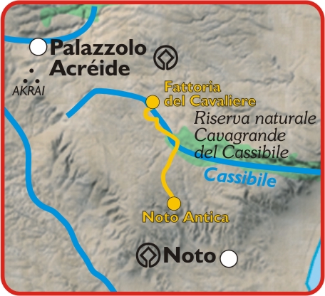
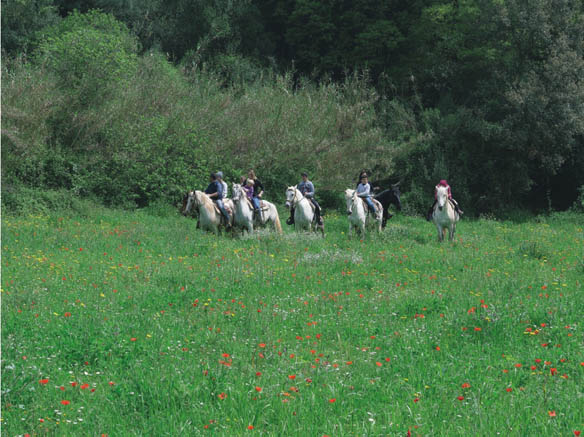
Starting point: Palazzolo Acreide (SR)
– altitude a.s.l .: about 450 m
– route lenght : about km 25
– travel time : 6 hours (combined pace) 1 hour break
– technical difficulty: medium
– required equipment: gaiters/boots – cap/helmet
– available boxes : 20
– recommended period : between 20 March and 15 April
ph. Paolo Barone
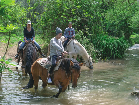
This path allows to combine wellness and fun, immersed in a generous landscape full of rivers flowing through a lush Mediterranean scrub, among hidden paths, hills and valleys providing inexpressible beautiful views.
This area, lying between the valley of the Anapo river and that of the Manghisi river, is rich in historical evidence dating back to the Greek-Roman period and offers the opportunity to visit, on horseback as well, some important sites representing the richness of Sicilian Baroque Style, included in the Unesco World Heritage.
The route lenght is about 1 to 2 hours, but it can may last even all day long, including the opportunity of some barbeque or night gatherings, thanks to the accomodation facilities provided with rooms and horseboxes stables.
Share this content!
LOCATION
DURATION
Distance
Difficulty
Places
AROUND
Way of the Madonite Shrines
Would you like an experience that combines faith and nature? Discover the Way of the Madonie Shrines, a Marian itinerary [...]
The Etna Castles Route
The Via dei Castelli dell'Etna is an itinerary of art, history, beautiful landscapes and traditions. The stars of the route are [...]

YOU MAY ALSO BE INTERESTED
Via Francigena Fabaria
The Via Fabaria is an important artery of the Sicilian Magna Via Francigena. Discovered as a result of landscape archaeology [...]
A complete tour of Sicily by road bike – Sea, temples, and Baroque architecture
This Komoot collection invites you to experience a cycling adventure in the heart of the Mediterranean: a route that takes [...]
Sicily by water: an itinerary through canyons, rivers, and springs in the island’s interior
When you think of Sicily, your imagination immediately turns to the sea. Yet, far from the coast, the island boasts [...]
